In this guide, we take a detailed look at just how big the Emerald Isle is and also how it stacks up against countries such as the US, UK, its European neighbours and various US States.
As of 2022, it’s estimated that around 70 million people worldwide claim Irish heritage. Also, considering the impact Ireland has had on the world in so many ways, from music and literature to the world-famous St. Patrick’s Day, you’d think Ireland would be substantial in size and population.
Surprisingly, Ireland’s physical size and population are not considered large compared to other countries. Below, you’ll see the results of our findings after having compiled data related to countries and US States which are both comparable in size to Ireland and enormous compared to Ireland!
But first, it’s vital to know what we mean when we talk about how big Ireland is.
The island of Ireland geographically refers to both the Republic of Ireland and Northern Ireland. The former takes up round 80 % of the whole island, and the latter, the remainder.
Politically, Northern Ireland belongs to the United Kingdom and the Republic is an independent state. Therefore, it’s important to keep in mind that the size of Ireland can mean either the size of the whole island or just the Republic.
In any case, we have covered both entities below!
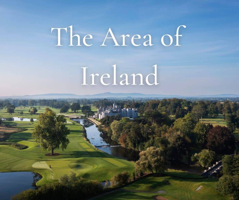
How Big is Ireland?
The island of Ireland consists of both the Republic of Ireland (70,273 Km²) and Northern Ireland (14,148 Km²) These two regions combined equal a total area of 84,421 Km² (32,595 mi²) making it Europe’s third largest island and the twentieth largest in the world.
The 2 largest islands in Europe are Great Britain (200,000 km2) and Iceland (101,000 km2).
Which countries are similar in size to the whole island of Ireland?
In order to draw a comparison, the parameters that were chosen are the following: The range is limited to +/- 10,000 Km². So, with this in mind, let’s check out the 10 countries which are similar in size to the island of Ireland (84,421 km2)
| Panama | Czechia | French Guiana | United Arab Emirates | Austria | Azerbaijan | Serbia | Jordan | Portugal | Hungary |
| 75,417 | 78,865 | 83,534 | 83,600 | 83,871 | 86,600 | 88,361 | 89,342 | 92,090 | 93,028 |
This shows us that the country which is closest in size to the island of Ireland is Austria.
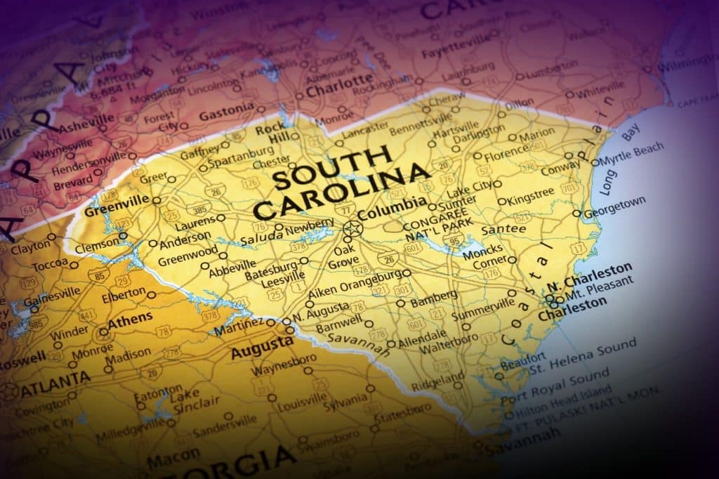
Which US States are similar in size to the whole island of Ireland?
The US State of South Carolina is closest to the island of Ireland in size. This state having an area of 82,933 Km². Other states which are relatively similar in size are Maine and Indiana with those having an area of 91,633 and 94,326 Km² respectively.
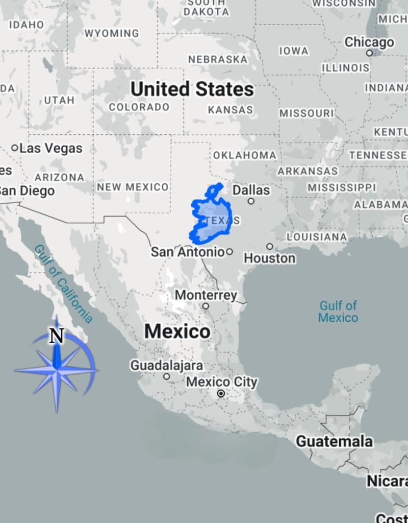
What about other US States such as Texas & California? How do they compare to Ireland?
| Country/State | Land Area (sq km) | Comparison to Ireland |
| Ireland | 84,421 | – |
| Texas | 695,662 | 8.24x larger |
| California | 423,967 | 5.03x larger |
| Alaska | 1,723,337 | 20.42x larger |
| New York | 141,297 | 1.68x larger |
| Florida | 170,312 | 2.02x larger |
| Montana | 380,831 | 4.51x larger |
| Arizona | 295,234 | 3.50x larger |
| New Mexico | 314,917 | 3.73x larger |
What size is the whole island of Ireland compared to the 5 largest countries?
Incredibly, Ireland fits into Russia 202 times. Let’s see how the rest of the largest countries compare:
| Country | Land Area (sq km) | Comparison to Ireland |
|---|---|---|
| Ireland | 84,421 | |
| Russia | 17,098,242 | 202x larger |
| Canada | 9,984,670 | 119x larger |
| China | 9,706,961 | 116x larger |
| USA | 9,372,610 | 112x larger |
| Brazil | 8,515,767 | 101x larger |
How big is the Island of Ireland compared to various other countries?
| Country | Land Area (sq km) | Comparison to Ireland |
|---|---|---|
| Ireland | 84,421 | |
| Germany | 357,022 | 4.23x larger |
| France | 551,695 | 6.54x larger |
| Netherlands | 41,543 | 0.49x smaller |
| England | 130,395 | 1.54x larger |
| UK | 243,610 | 2.88x larger |
| Spain | 505,992 | 6.00x larger |
| Australia | 7,692,024 | 91.22x larger |
| New Zealand | 268,021 | 3.17x larger |
| Iceland | 103,000 | 1.22x larger |
What countries are similar in size to the Republic of Ireland?
While using the same parameters as above i.e. the range being limited to +/- 10,000 Km², the following countries are similar in size to the Republic of Ireland (69,797 Km²)
| Latvia | Lithuania | Sri Lanka | Georgia | Sierra Leone | Panama | Czechia |
| 64,559 | 65,300 | 65,610 | 69,700 | 71,740 | 75,417 | 78,865 |
This shows us that the country which is closest in size to the Republic of Ireland is Georgia.
What US States are similar in size to the Republic of Ireland?
As there is huge disparity in the size of US States, there is only one which falls within the outlined range of +/- 10,000 km² and that is the state of West Virginia. The state of West Virginia has a size of 62,756 km² (24,230 sq mi) , therefore making it the state closest in size to the Republic of Ireland.
What is the size of Ireland in acres?
The whole island of Ireland is 20,860,883 acres in size, whereas the Republic is 17,247,214 acres.
What is the length and width of Ireland?
The most northerly point in Ireland is Malin Head, in County Donegal and the most southerly is Mizen Head in County Cork. As the crow flies, that’s a distance of 678 km. The drive can be done in approximately 8 hours (the fastest route).
The maximum width of Ireland is only 275 kms!
The furthest point from Dublin City is Dursey Island, in County Cork – a distance of 400 kms.
Dublin is linked to the cities of Limerick, Galway and Cork via motorway. Dublin to Cork takes approximately 3 hours, Dublin to Galway approximately 2.5 hours and Limerick just over 2 hours.
How long does it take to drive across Ireland?
From Dublin City in the far east of the country to Achill Island in the far west, it is a driving distance of 295 km. That equates to a driving time of approximately 4 hours. From the most northerly point (Malin Head) to the most southerly point (Mizen Head), that is a driving distance of 708 km, which equates to a driving time of 8 hours.
10 Essential Geographical Facts about Ireland
1. Inculding all the intricate bays, peninsulas, coves, beaches and the coastlines of Ireland’s offshore islands, Ireland’s coastline is approximately 7,500 km in length.
2. There are approximately 80 islands off the coast of Ireland, of which 20 are inhabited.
3. Ireland’s largest offshore island is Achill Island, in County Mayo.
4. Ireland’s highest mountain is Carrauntoohil (1038 m) , located in County Kerry, in the south-west of Ireland.
5. Ireland’s longest river is the River Shannon, at a length of 360 km. It meanders its ways through the centre of the country, eventually flowing into the Atlantic Ocean at the Shannon Estuary, on the border between Kerry and Clare.
6. Ireland’s largest lake is Lough Neagh, located in Northern Ireland. The largest lake in the Republic is Lough Corrib, located primarily in County Galway.
7. Ireland’s highest cliffs are located on Achill Island. Croaghaun reaches a height of 688 metres. They are also Europe’s second highest sea cliff, after Hornelen on the Faroe Islands.
8. Ireland’s largest county is County Cork, while the smallest county is County Louth.
9. Ireland is divided into 32 counties, 26 in the Republic and 6 in Northern Ireland.
10. Ireland’s capital city is Dublin, and also its largest, with its metropolitan area having a population of 1,256,000.
The Landscapes of Ireland
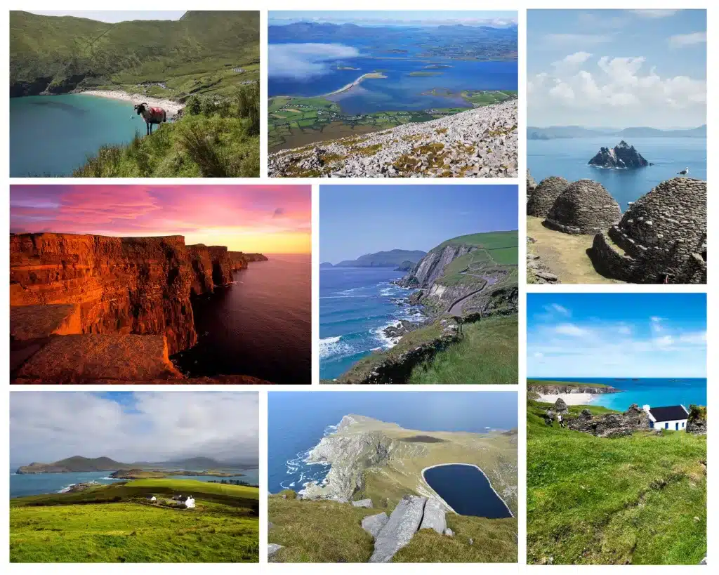
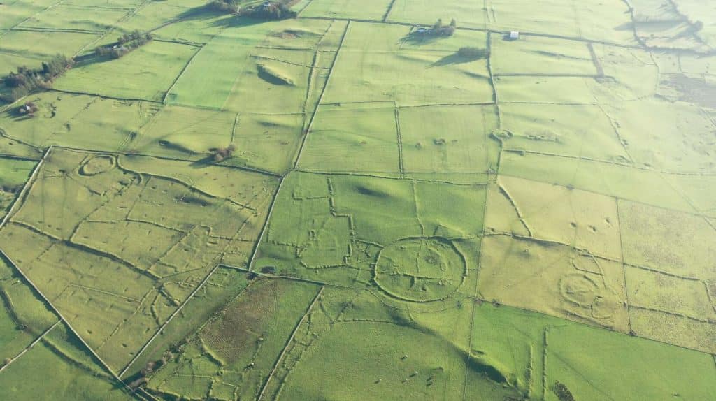
For a relatively small island nation, Ireland possesses a wide variety of natural landscapes, from mountains, valleys and lowlands to soaring cliffs. Also, due to its relatively low popultion density, many of these landscapes are completely untouched and void of any human interference. For more details on these spectacular landscapes, have a look here.
FAQs
What country is similar in size to the island of Ireland?
The country closest in size to the island of Ireland (84,421 km2) is Austria (83,871 km²)
What country is similar in size to the Republic of Ireland?
The country closest in size to the Republic of Ireland (69,797 km2) is Georgia (69,700 km²)
What US State is similar in size to the island of Ireland?
The US State of South Carolina is closest to the island of Ireland (84,421 km2) in size. This state having an area of 82,933 Km².
What US State is similar in size to the Republic of Ireland?
The US state of West Virginia has a size of 62,756 km² (24,230 sq mi) , therefore making it the state closest in size to the Republic of Ireland (69,797 km2)
Conclusion
We hope you have enjoyed learning about the area of Ireland and how it compares to other countries. It’s quite amazing that for such a small country, Ireland certainly has contributed a lot to our present-day society.
If you are interested in finding out more about Ireland and learning some quirky facts, click here. We’d also like to know if you have any more observations or any questions in general about Ireland. Drop us a line, we’d be delighted to hear from ye! Slán Go Fóill!