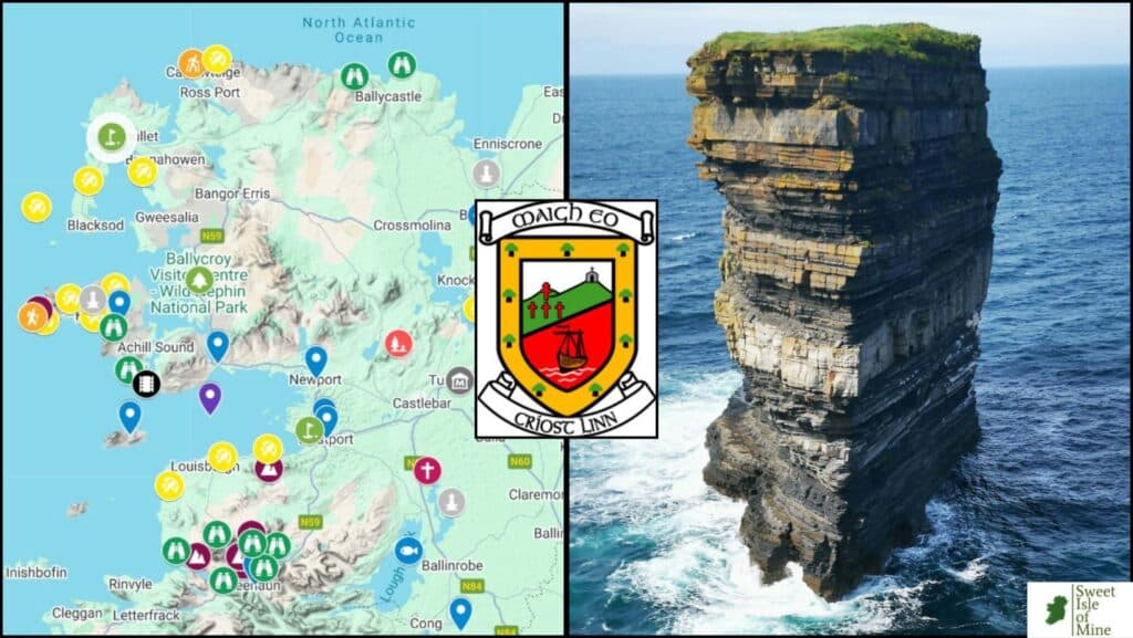
Planning a trip to County Mayo? This interactive Mayo map includes the county’s top attractions, scenic drives, beaches, mountains, historic sites, towns and hidden gems.
Created by a Mayo local, it’s designed to help you discover both the famous highlights and the lesser-known places that most visitors miss along the Wild Atlantic Way.
You’ll find:
- Mayo’s best tourist attractions
- Beaches, mountains, scenic viewpoints
- Historic sites and abbeys
- Recommended towns & villages
- Walking trails & coastal drives
- Film locations, golf courses, fishing spots
The interactive map appears below.
Almost every marker includes a direct link to a detailed local guide with tips, walks, parking information and nearby attractions.
Planning a Trip to County Mayo?
County Mayo is best explored by car, especially if you want to visit remote beaches, winding country roads, mountain passes and coastal viewpoints.
Useful Mayo Travel Resources
Find accommodation in County Mayo
Find accommodation in Westport
Compare car rental prices in Ireland
Book tours and outdoor activities
About This County Mayo Map
Completely Free to Use
The map is free to use and includes many attractions that are also free to visit.
Famous Attractions & Hidden Gems
You’ll find iconic Mayo locations such as:
But I’ve also included lesser-known places such as Glenummera Valley, Sheeffry Pass and Ben Gorm — places rarely featured in traditional guidebooks but among the most beautiful areas in Mayo.
Detailed Local Guides
Each marker links to a dedicated article with local travel tips, viewpoints, walks, photography spots and nearby attractions.
Easy-to-Use Categories
The map uses colour-coded markers for:
- towns and villages
- mountains
- beaches
- scenic viewpoints
- walking trails
- historical sites
- golf courses
- fishing locations
- film locations
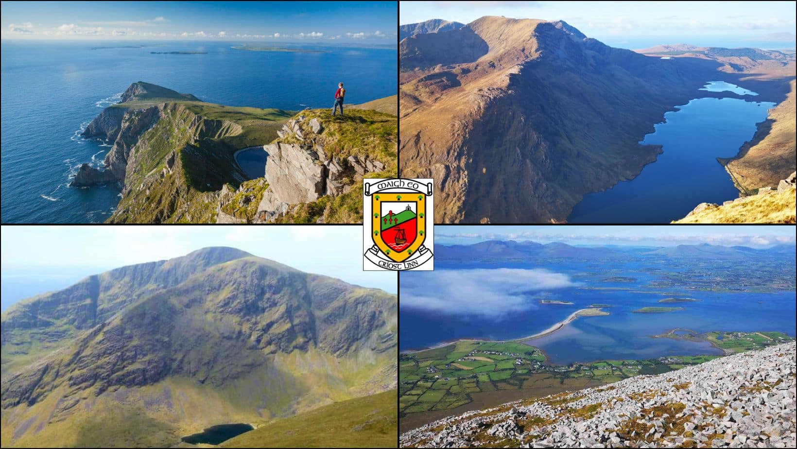
Best Areas to Explore in Mayo
West Mayo has the county’s highest concentration of dramatic scenery, particularly around:
Further inland, highlights include:
My Interactive County Mayo Map
Need Help Planning Your Mayo Trip?
I now offer personalised trip-planning consultations for visitors exploring Mayo, Galway, Connemara, Achill Island and the Wild Atlantic Way.
How to Use the Map
Zoom in to explore different regions of Mayo
Click on markers to discover attractions and local tips
Open linked guides for detailed travel information
Save locations to help plan your Mayo itinerary
Mayo Beaches on the Map (Yellow Markers)
These markers highlight some of the best beaches in County Mayo, including:
Several include detailed guides covering parking, swimming, nearby walks and photography locations.
Mayo Mountains & Hiking Trails (Purple & Orange Markers)
These markers represent mountains and walking trails I’ve personally explored and highly recommend.
Highlights include:
Although Mayo’s mountains are not especially high, many hikes are challenging due to rugged terrain and Atlantic weather conditions.
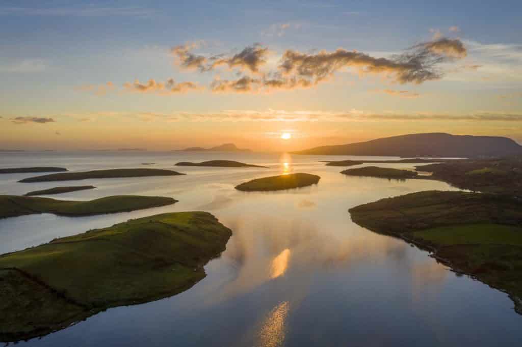
Scenic Locations & Coastal Drives (Green Markers)
These markers highlight some of the most scenic places in County Mayo.
Some favourites include:
These are the places that truly showcase Mayo’s wild Atlantic landscape.
Towns & Villages on the Map (Blue Markers)
The blue markers represent towns and villages that make excellent bases for exploring Mayo.
Westport
Westport is one of the best places to stay in Mayo thanks to its:
- access to Clew Bay and Croagh Patrick
- excellent restaurants and pubs
- accommodation options
- lively atmosphere
Other Recommended Bases
Ballina
Newport
Louisburgh
Historical Sites in Mayo (Grey Markers)
County Mayo is home to some of Ireland’s most fascinating historical sites, including:
- Rosserk Friary
Mayo has one of the highest concentrations of ancient archaeological sites in Ireland.
Film Locations in Mayo (Black Markers)
Several famous films were shot in County Mayo, particularly around Achill Island.
Fishing & Golf Locations (Blue & Green Markers)
Mayo is famous for both fishing and links golf.
Highlights include:
Carne Golf Links
Mulranny Golf Club
River Moy and Ballina Ridge Pool
Lough Mask
Deep sea fishing along the Mayo coast
Frequently Asked Questions About County Mayo
Here are the most common questions I have been asked about County Mayo down through the years.
What are the main towns in County Mayo?
Castlebar (pop. 13,054) Castlebar is the county town of County Mayo
Ballina (pop. 10,556)
Westport (pop. 6,872)
Claremorris (pop. 3,857)
Ballinrobe (pop. 3,148)
Ballyhaunis (pop 2,773)
What is County Mayo famous for?
- dramatic coastal landscapes
- Achill Island
- Croagh Patrick
- Keem Beach
- Wild Atlantic Way scenery
- Clew Bay
- salmon fishing
- ancient archaeological sites
What are some interesting facts about County Mayo?
Mayo has the longest coastline in Ireland at over 1,100 km
Clew Bay is famous for its 365 islands
Croaghaun Cliffs on Achill Island are among Europe’s highest sea cliffs
Mayo is home to Ireland’s only fjord, Killary Harbour
Céide Fields contains the world’s oldest known field systems
Ballycroy National Park is one of Europe’s largest blanket bog systems and a designated Dark Sky Park
Final Thoughts
I hope this interactive Mayo map helps you plan your trip and discover some places you may otherwise have missed.
I’ve spent most of my life exploring County Mayo and still regularly come across hidden beaches, quiet valleys and spectacular viewpoints I had never noticed before.
Whether you’re planning a Mayo road trip, a Wild Atlantic Way adventure or simply looking for the best places to visit in Mayo, I hope this guide helps you experience the county at its very best.