
The Cliffs of Croaghaun on Achill Island are the highest cliffs in Ireland, standing at 688 metres. In my view, this hike is one of Ireland’s most magnificent outdoor activities.
It is, however, a challenging, unmarked hike across rugged, boggy terrain with no clear trails, but the views from its summit are unrivalled.
Proper preparation is essential for safety and enjoyment. This article will guide you every step of the way as I have personally climbed these cliffs over 20 times. I am delighted to share my route and tips to ensure a day that will live long in your memory.

Height
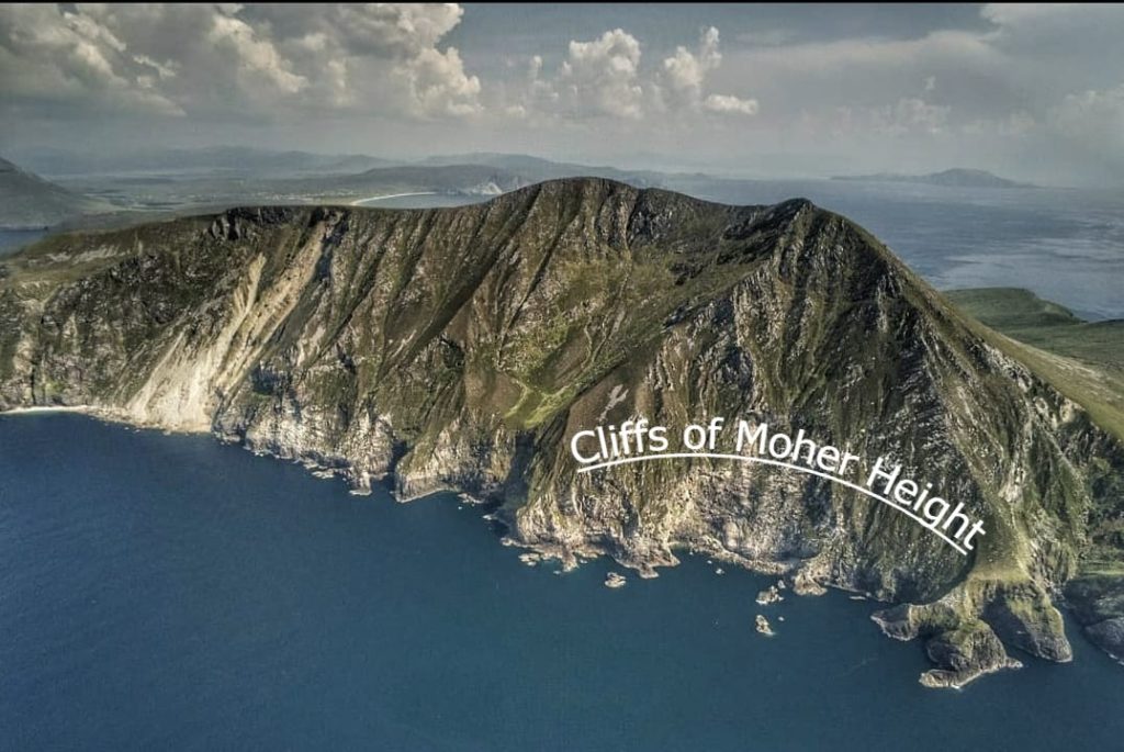
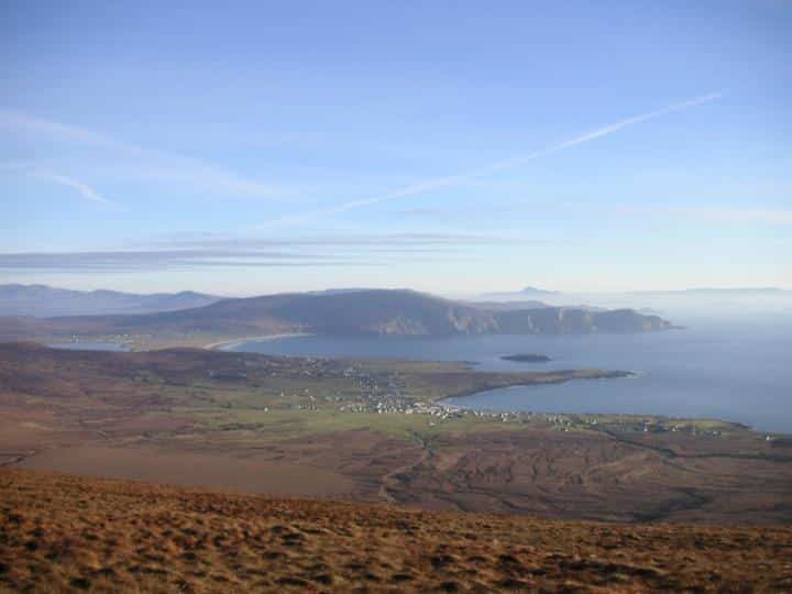
As mentioned, these cliffs stand at 688 metres or 2,257 feet. That makes them the highest cliffs in Ireland and the second highest sea cliff in Europe.
To put it in perspective, that’s over 3 times higher than the world-famous Cliffs of Moher (214 metres) and 87 metres higher than the mighty Slieve League (601 metres). This aerial image shows the sheer scale of these cliffs.
Location
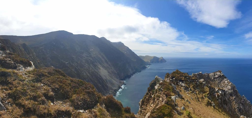
The Cliffs of Croaghaun are located on the western end of Achill Island in County Mayo. They are the highest point of a vast array of cliff faces which start at Keem Bay.
These vertical rockfaces traverse along the whole western end of the island to Achill Head, then following the north-western shores to Croaghaun, where they continue to the wild and remote Saddle Head.
They finally come to a dramatic end near the beach of Annagh. From start to finish, this complete range covers a distance of approximately 18 km.
Here is the exact location of the cliffs. Note the almost never-ending cliffs in this area of Achill Island.
How long does it take to climb Croaghaun?
The route we are going to show you will take on average 4-6 hours to complete, depending on level of fitness and stops along the way. The hike covers a distance of approximately 10 km. Put aside a good half day for the hike.
Is there a clear trail?
No, there is no clear trail to the top of the cliffs. You must know in advance exactly what route you are going to take and stick to it.
The ground underfoot is soft peatland and coarse grass. In places in can be quite soggy, so it is highly advised to carry out the hike during a spell of dry weather.
Difficulty
The hike is divided into 8 sections, which we will get on to later. These sections range from completely flat to a real scramble, where the topography is steep and extra care is needed.
Overall, due to the length of the hike, the soft underfoot, the precarious slopes and the steepness of some sections, we would classify this as a challenging/difficult hike.
Safety
We will break this section into what you should bear in mind when climbing the Cliffs of Croaghaun.
Weather
This part of the world is notorious for changes in the weather. Its exposed location on the edge of the Atlantic Ocean, coupled with its high altitude means you must choose a clear/dry day for the hike.
It can also get very windy up here. We also strongly advise that you choose a calm day. Even on a relatively calm day down at sea level, there can be a lively breeze/wind at the summit of Croaghaun.
Do not attempt the climb if there are lingering clouds on the summit. There is no path, which means you may lose your orientation on the ascent/descent.
Before you carry out your hike, check the cloud ceiling for that day.
Go for a cloud ceiling of at least 700 metres. Check wind for that day and if any Atlantic fronts are due to hit. Met.ie or accuweather are your best go-tos for this.
What time of the year should you do the hike?
We don’t recommend any specific time of the year for the hike as we have completed it in all seasons, including winter. Just be wary of the short days and start good and early.
The most stable weather in Ireland is, generally speaking, May and September. You’ll get a good 12-14 hours of daylight in these months along the west coast of Ireland.
Altitude/Cliff face
If you have a fear of heights, you should absolutely not do this hike.
There are some mind-boggling drops directly down into the Atlantic Ocean. The cliff edge is precariously close to the trail at some points and care must be taken.
We advise to never go too close to the edge. Here is a little anecdote to strengthen our point:
The first few years we visited these cliffs we always passed by a section called ‘The Kitchen’. This was an unusual landform, almost like a miniature valley at the edge of the cliff.
It was possible to walk down this ravine and come up the other side, where you would find yourself directly at the edge of the cliff (we never, ever did this!)
On a more recent trip there, while viewing the cliffs from Saddle Head, I noticed a huge section of the cliff had collapsed into the sea below. Lo and behold, it was that exact place: The Kitchen.
This image was taken before the event happened and you can see this outcrop of rock jutting out. This enormous section of rock had broken off under the pressure of the sea erosion below.
Stay away from any precarious locations.
To sum up, a good level of fitness, some experience with high-altitude trekking and a good calm, clear day are all required to take on this hike.
What do I need to bring for the hike?
1) Waterproof hiking boots (the whole terrain is peat/bogland)
2) Water
3) Snacks
4) Waterproof hiking trousers
5) A light rucksack
6) Raingear
7) Camera/Phone
8) Change of clothes if necessary
9) Warm gear depending on time of year/down jacket or similar lightweight warm jacket/cap
10) Walking Pole/Stick
11) Suncream (don’t laugh-you’ll get sunburned on a warm day up here-no doubt!)
12) Compass
The Hike
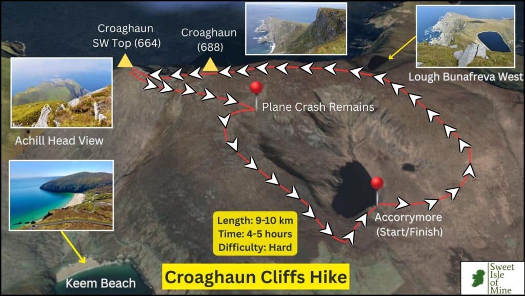
Below is a map I put together of the hike, which starts and finishes at Accorrymore Lake.
Disclaimer: This map is provided for informational purposes only and is not guaranteed to be accurate or error-free.
It is possible to get to the summit of the cliffs from either Keem Beach or from Lough Accorymore. The hike from Keem is more direct but a lot more challenging than from Accorymore.
Starting the hike from Keem, we feel, is far too steep and exposed for those not accustomed to steep mountain trekking. There have been multiple cases of people attempting to climb from Keem and having to turn back, due to the incredible exposure and steepness.
The steep terrain from Keem is very evident from the graphic above, with a difference in elevation of almost 700 metres in the space of 1 km.
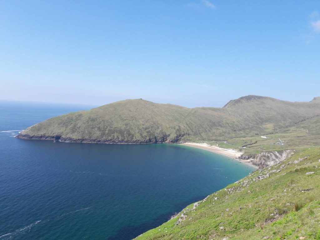
We recommend starting from Accorymore, also because you will witness one of Ireland’s most spectacular glacial lakes (Bunafreva West)
Start off by parking in this exact location. On the way to Keem Beach, after the village of Dooagh, the road will start to climb. It’s quite easy to miss the turn for ‘Lough Accorymore and Water Treatment Works’. Take this right and follow the road for a mile or so. Park here:
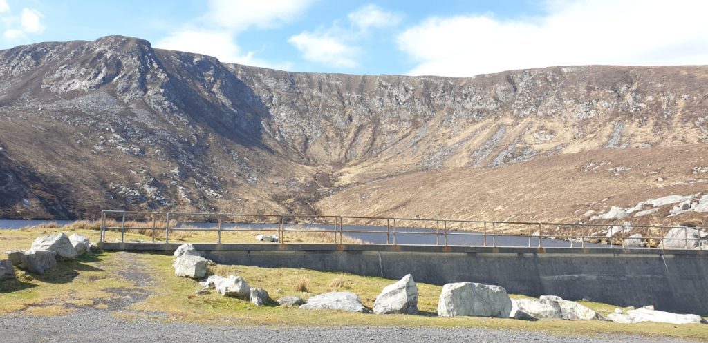
The hike is broken up into 8 sections.
Note: We have a shorter alternative route outlined below. This however does not take in the cliff-top corrie lake of Bunafreva West.
Disclaimer: The route below is a recommended route and not the exact GPS co-ordinates
Here are the first 3 sections:
Section 1
This first section you will start with a relatively flat walk for approximately 1 km. You will see the hill you will start to climb to your left hand side.
After approximately 1 km, it’s time to start thinking about your first proper climb.
Section 2
This is your first steep climb and you will gain altitude very quickly. As mentioned, you should start the ascend approximately 1 km after your initial walk along the bottom of the slope.
Whenever you feel comfortable making that left turn up the slope, then go for it. But do not start too early as you’ll find it too steep and too dangerous.
This section will get the heart going – take your time and take some breaks to admire the incredible view behind you of Keel Beach and Minaun Cliffs.
Section 3
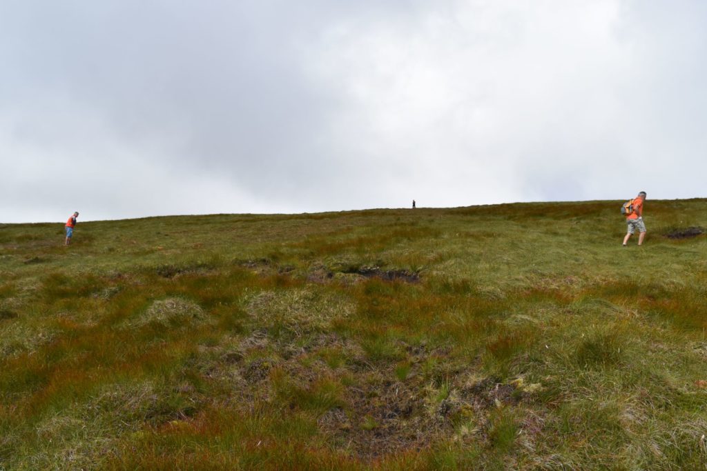
When you get to the top of this steep section, you’ll notice it gets quite flat. You’ll pass by some pools and some open peatland.
You will find yourself in pure wilderness now and thinking ‘God, where are these cliffs?!’ The peak of Slievemore will now also be in view.
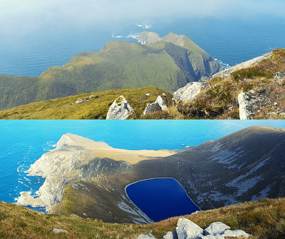
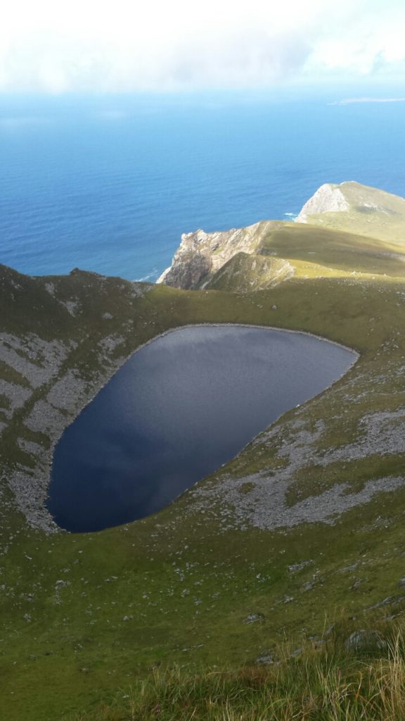
Keep going along this flat area till you get to your first stop over – Lough Bunafreva West. Your GPS should start working on your phone again on this flat section, after more than likely losing it on the steep section.
This corrie lake almost resembles a crater when viewed from above. It almost defies logic the way it is perched perfectly on the cliff edge surrounded by high rock faces.
Next up, we have the following 3 sections. Here, an outline:
Section 4
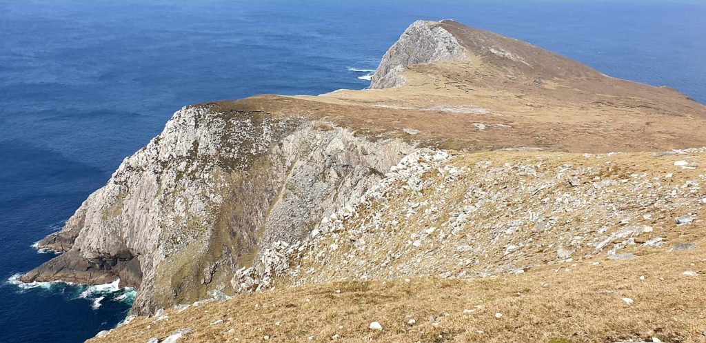
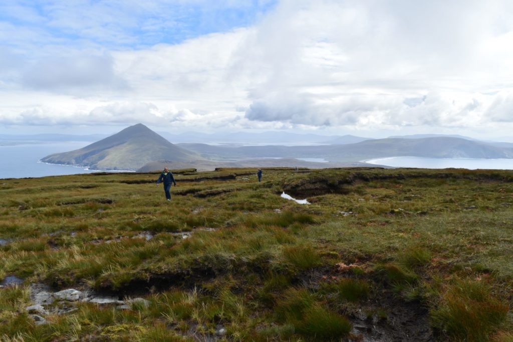
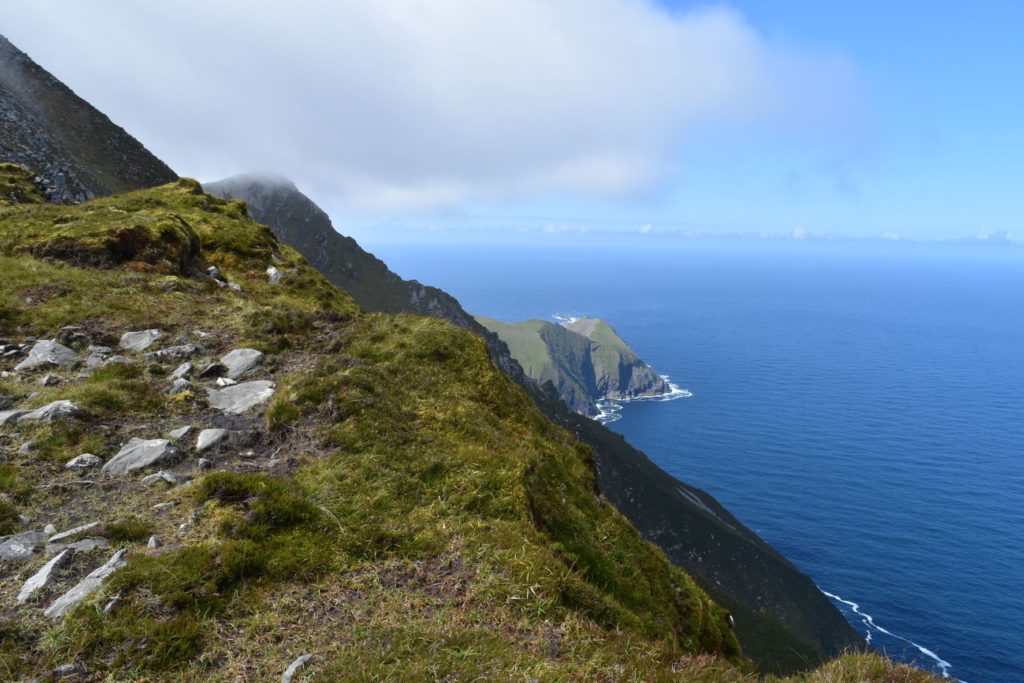
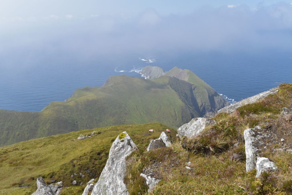
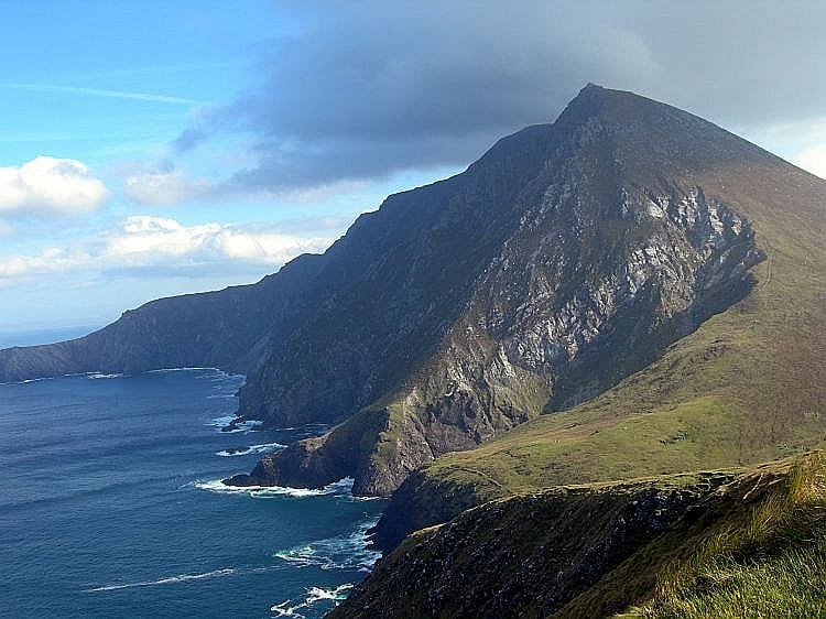
By now, you will catch your first proper sight of the peaks of Croaghaun to the left. Start making your way along the cliffs towards the peak.
Be careful not to go too near the edge here. These first cliffs are over 500 metres in height. After the long slog through the open peatland, the views now start to open up spectacularly.
You’ll also get your first glimpse of Achill Head:
The second half of this section is the most challenging.
By now you should have followed the most direct way to the first peak, along the cliff top. Now start the steep ascent to this peak, Croaghaun. This is the highest point of your hike.
Keep away from the cliff edge here.
Here, the terrain will get rocky and you may find yourself scrambling. This last ascent to the summit is quite steep but it is relatively short. Take your time and choose the easiest route to the summit, while always staying to the left.
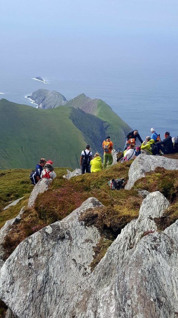
You’ve reached your first summit and you’ll see a marker at the top! Have a break, get some water in – there’s still a good distance to go.
Section 5
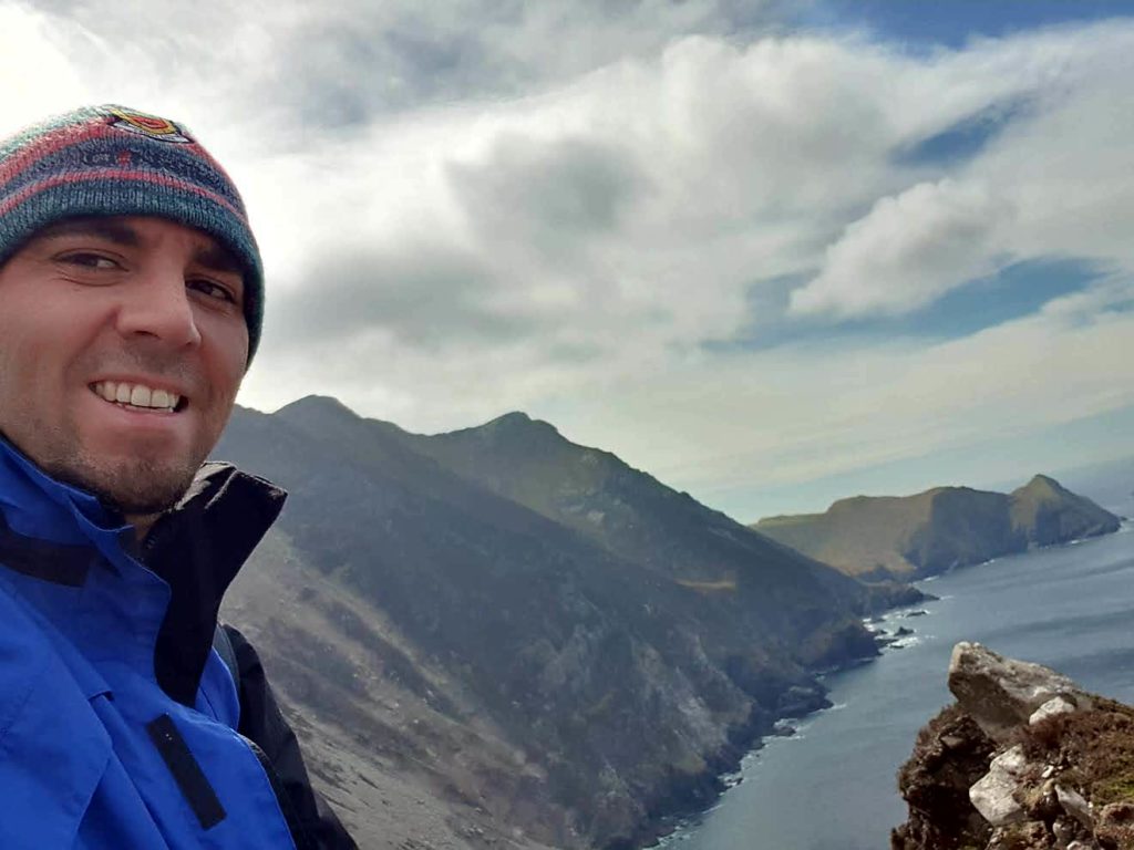
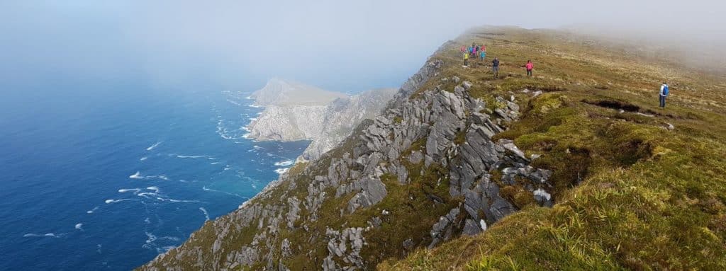
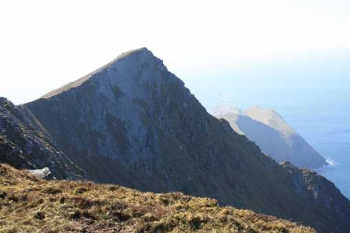
Now, you are going to make your way along a high mountain ridge in the direction of Croaghaun Southwest Top. This is a wonderful walk and the views and sheer scale of the landscape is breathtaking.
Keep going all along the ridge towards the pyramid-shaped peak. Here are some images of this section to whet your appetite:
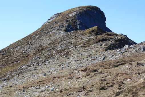
Section 6
This will be your final ascent for today and extra care is needed here again. We say it is vital again that you approach this ascent from slightly behind the peak of Croaghaun Southwest Top.
The image below will show you exactly why you should approach from behind the peak.
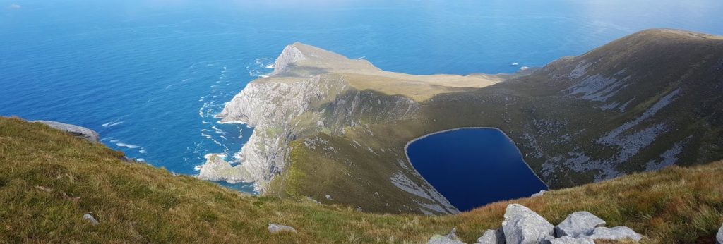
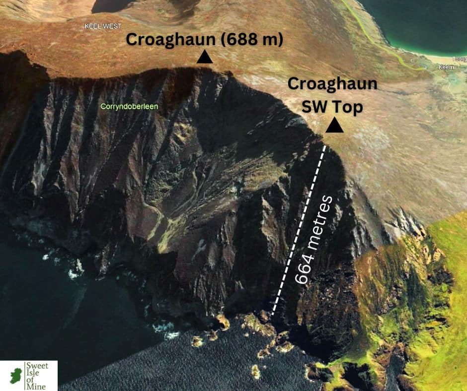
From Croaghaun Southwest Top, there is a vertical drop into the Atlantic Ocean of 664 metres. In fact the most vertical cliff face of the whole Croaghaun massif is found at this section. Having a drone here would capture the sheer cliff face perfectly. Otherwise the image below gives an idea of the scale.
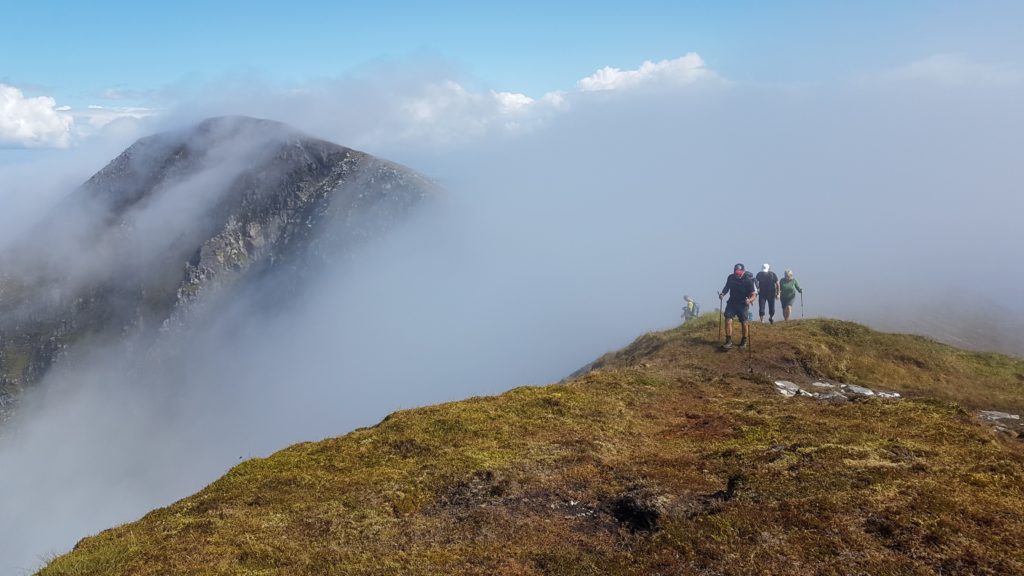
When you reach the summit of Croaghaun SW Top, the panoramic views all around are a sight to behold.
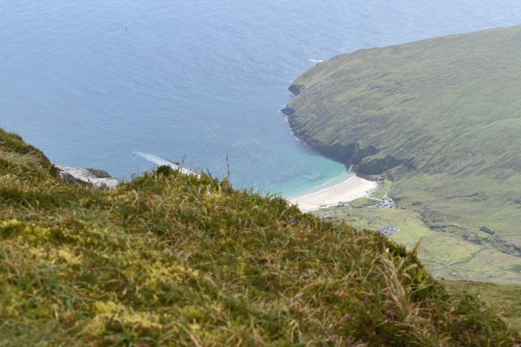
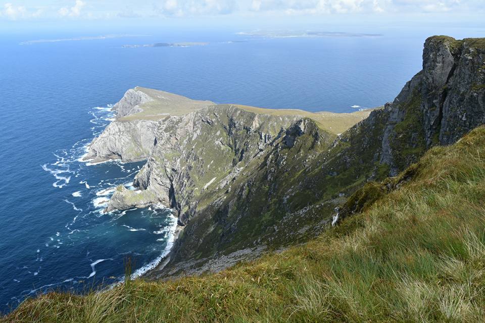
From the summit of Croaghaun Southwest Top, you’ll see the ‘Dragon’s Tail’ i.e. Achill Head, snaking its way out to the Atlantic Ocean and Keem Bay looking miniscule.
Take as long as you need up here. It’ll be hard to leave this place. We believe this to be the highlight of the hike.
Once again a saftey warning.
At this point, there is very limited ground to move on and it may take a few minutes to get your bearings, due to the dizzying height you are at.
The ground drops off vertically in most directions. Don’t venture anywhere near the cliff-edge here. Just sit down and take in the epic views all around you!
Section 7
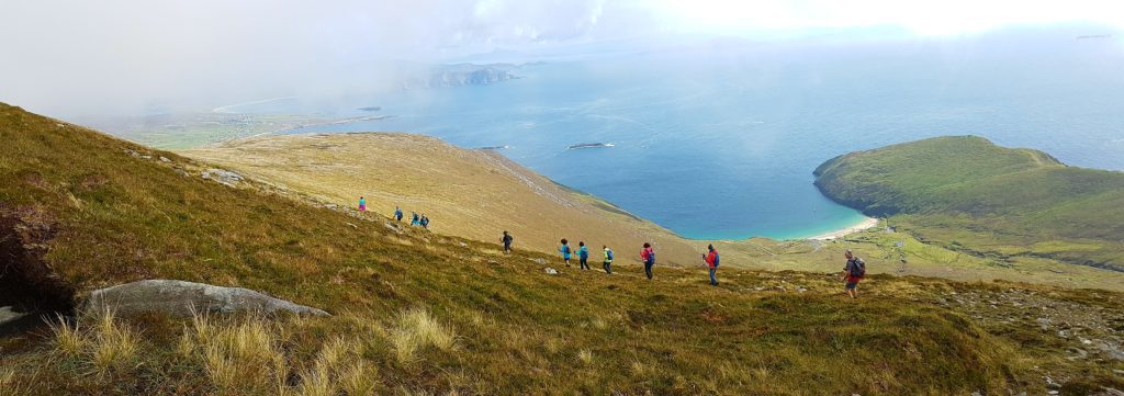
Now it’s time to start your descent (unfortunately) But don’t worry, there’s another highlight on the way.
Here is an outline of the route we follow when descending:
Start your descent using the guidelines in the map above. It’s best to approach this descent keeping in mind that you are running parallel to the cliffs you just traversed (see image below)
This is the safest and least-strenuous way. The walking poles will come in handy here.
Next port of call is the blue marker labelled on the map above. But first take in the magnificent views on your way down:
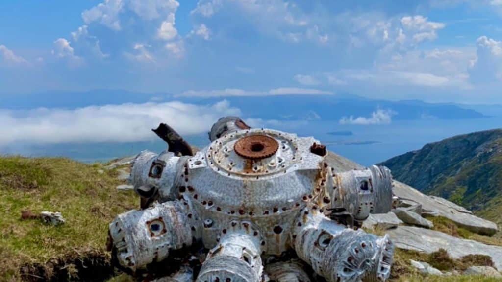
Hopefully, you have followed the route in the map above. The blue marker shows the approximate location of the place crash remains, but it’s no more than 50-100 feet away from this spot.
There is a large rock painted white to mark the spot, which you will notice once you are close to the site. In fact, this white rock can clearly be seem from the car park at Lough Acorrymore.
What you will see is the remains of the engines of the RAF Halifax Bomber, which crashed here in 1950, taking the lives of all 8 crew members on board. The exact details of this tragic event can be found here.
Section 8
Using the route outlined above, make your way around the glacial cliff faces surrounding Lough Accorymore. Be careful, this final descent is steep, so practise caution.
Now you’ll experience a totally different landscape: the beautiful glacial valley of Accorymore.
Maybe you’ll spot Mrs. McCormick i.e. The Banshee of Inisherin on your way down!
You’ll soon see the road you drove down earlier to the parking spaces at Lough Accorymore. Join this and make your way back to complete the loop.
Hike Complete
Great stuff, you’ve completed the hike. I hope it was an enjoyable one and that you were not too disappointed by the views!
Alternate Route to Croaghaun Cliffs
As already mentioned, there is a shorter alternate route to the cliffs. This also starts at Accorymore. Instead of going cross-country, you’ll backtrack a little along the road you just came and start to the left of the large corrie.
Make your way up this slope, where you’ll eventually meet a flat plateau, before the final sharp ascent to Croaghaun peak. This is an out and back hike.
The route is below. Once again this is approximate, use your navigational skills and choose a clear day.
What else is there to do in Achill Island?
If the feet are feeling a little swollen, why not go for a paddle in the nearby breathtaking Keem Beach? We have a comprehensive guide completed for you to help you make the most of it. Click here.
What a great way to top off a wonderful day: Keem Beach. When you are relaxing on this beach, you can look upwards towards the mighty Croaghaun and officially knock this hike off your bucket list.
There are loads of things to do and see on the island, including some incredibly scenic drives, tons of wonderful beaches and water sports to try your hand at.
Have a look here for your ultimate guide to Achill.
Where to stay on Achill Island
There is a great selection of accommodation on Achill Island, and the vast of it is very reasonably priced. We recommend staying in the Keel, Dooagh area, as this is a good central location and has the most amount of places to eat, shops and pubs. We have accommodation on Achill Island covered here:
Croagh Patrick: Conquer Mayo’s Iconic Peak
If your trip to Ireland or Mayo is an adventurous one, why not tackle the mighty Croagh Patrick while you’re at it? This mountain, located near Westport is also quite a challenge, offering some more incredible views, with a fascinating history attached. We have a detailed guide here.
Other Hikes in the Region
Your questions answered about the Croaghaun Cliffs
What are the highest cliffs in Ireland?
The highest cliffs in Ireland are the ‘Croaghaun Sea Cliffs’, and reach a maximum height of 688 metres. They are located on the westernmost end of Achill Island, County Mayo, and mark the highest point on the island. The cliffs are notoriously difficult to access, yet offer the greatest reward in terms of incredible views, making it one of Ireland & Europe’s great coastal hikes.
How long does it take to climb the Cliffs of Croaghaun?
It takes on average 4-6 hours up and down if you complete the loop from Accorrymore, which is the safest and most rewarding route.
How high are the Cliffs of Croaghaun?
The highest point is 688 metres (2,257 feet). The second peak of the range, namely Croaghaun Southwest Top, has a height of 664 metres (2,179 feet)
How can you see the Cliffs of Croaghaun?
You can see the cliffs by either hiking to the summit, flying your drone, hiking to Achill Head or from the sea.
Is the Croaghaun Cliffs hike safe?
If you choose a clear, calm day, plan your route carefully and stay away from the edge, then yes it is safe.
Is the Croaghaun Cliffs hike difficult?
Because of the steep ascent, lack of a clear path and the sheer height of the cliffs, we would classify this as a difficult hike.
Final Thoughts
We hope you will get a chance to tackle the mighty Cliffs of Croaghaun. If you do so, stay safe and use some good old common sense while you’re there. Plan well in advance, get a good idea of the route to take and be prepared.
Remember, if you tackle the alternate, shorter route, this is significantly shorter than above, but you’ll miss Lough Bunafreva West, and we believe this is unmissable.
Before we head off, I feel I have to mention an incredible visual representation of this area of Achill Island. For anyone you wants to have a night or 2 in paradise they will never forget, after watching this video, you’ll be running to your nearest outdoor shop!
Enjoy Gerry McVeigh’s incredible wild camping adventure
To finish off, we would be thrilled to hear how you got on on your hike and if there are any tips you would like to share, please do so. We’d be delighted to hear from ye. Slán go fóill!
This is a fantastic hike with Breathtaking views.
Lough Bunafreya West is another incredible experience.
I have done this hike many times & even wild camped in this awesome area. I am a Failte Ireland Tour Guide who specialises in County Mayo only, as there’s so much to see & experience here. I take many Tour groups & they are so impressed with Achill Henge, especially the amazing story behind it. Regards Derek Davidson at Walk West Ireland.
Hi Derek,
Thanks a million for your comment. It’s Ireland’s greatest hidden gem and feels like you’re actually in somewhere like Madeira or Hawaii when you’re up on top, the views from that height are that epic.
The corrie lake of Bunafreva is the icing on the cake in my view, so special. I’d say wild camping up there must be some experience. You’d definitely need a calm night for that!
Croaghuan cliffs have been massively confused with Croaghaun west, which is a townland behind Keem beach and everyone thinks they have climbed the highest cliffs when they take that small hike from Keem.
Hopefully this post and your guiding will help put this confusion to bed.
Hello.
Please, how many time from Acorrymore Dam to Bunnafreeva West Lough views? The three first sections?
Hi Marc,
You should do it in an hour and a half. Don’ start the ascent to your left too early though as it is quite steep. Hope this helps.
Niall
Hi Niall –
I have read your excellent step-by-step guide a few times as I prepare to visit from the US in a couple and solo hike Croaghaun (so I want to be sure I know what I’m doing) and some other spots around your lovely land. I can’t thank you enough – really great descriptions and tips.
Cheers,
Liz
Dear Liz,
Thank you very much for your lovely feedback. I try to make each article as detailed as possible. All locations in my site I have personally visited and genuinely think there are some great hidden gems in Mayo and Galway. If you know anyone else interested in visiting the west of Ireland, I’d appreciate if you could share the site.
All the best,
Niall