
Diamond Hill is easily one of the best walks in Connemara, and definitely one of the most accessible.
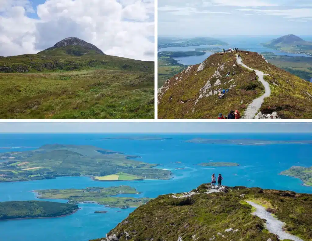
I’ve hiked both the Lower and Upper trails multiple times, and each time the panoramic views amaze me. From the summit, you get a breathtaking sweep of the Twelve Bens, the Atlantic coast and islands and of Kylemore Abbey nestled below.
In this guide, you’ll find everything you need to know before taking on the Diamond Hill hike: the 2 trail options, difficulty levels, what to bring, and some local tips to help you make the most of your day in Connemara National Park.
Handy Information To Know Before You Go
Location & How to get there by car
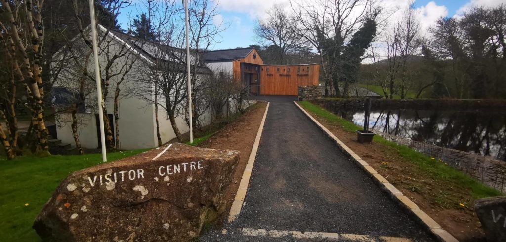
Diamond Hill is located in Connemara National Park, to the west of County Galway. From Galway City, it will take you 1.5 hours to reach the Connemara National Park Visitor Centre, where the hike starts.
The nearest large town to Connemara National Park is Clifden, only 20 miuntes away and is a lovely, lively town, and an ideal base for exploring Connemara.
From the scenic town on Westport, it’s only an hour’s drive.
This visitor centre is located near the village of Letterfrack, while also being within a few minutes’ drive of the world-famous Kylemore Abbey.
How to get there by bus
Citylink run a bus service from Galway City via Clifden.
This tour offers a beautiful scenic drive through Connemara and allows 3 hours at the visitor centre, which is the length it takes to do the hike (at a moderate pace)
The Name
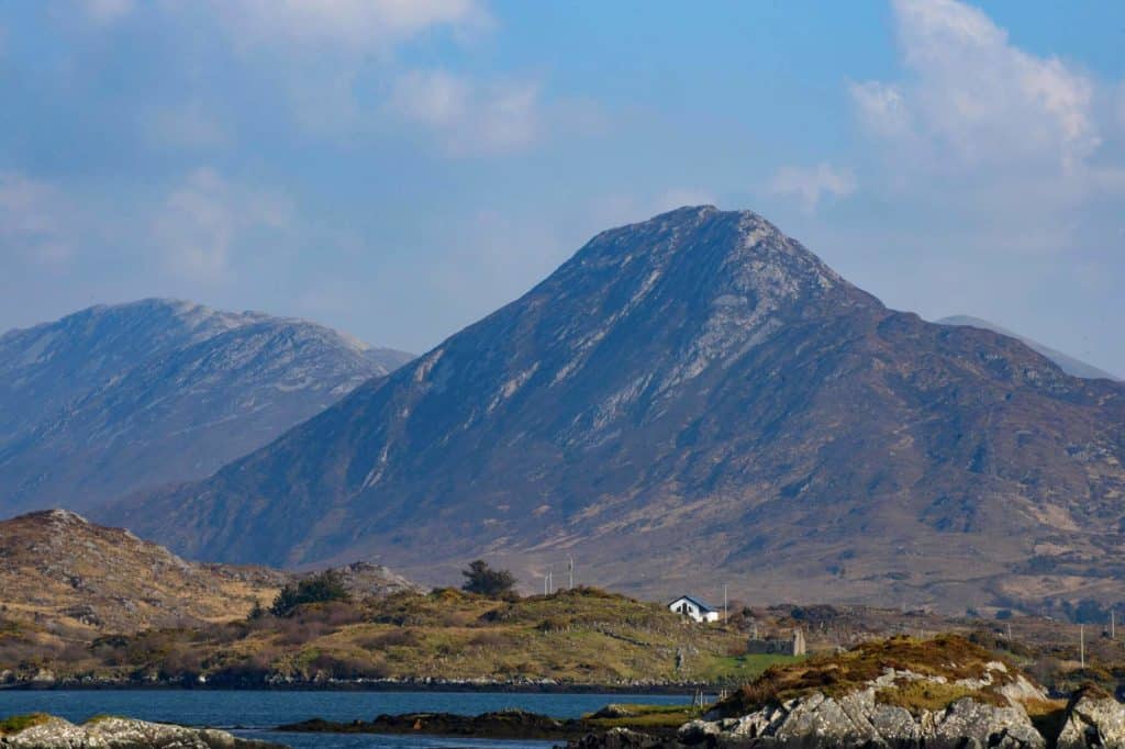
Diamond Hill relates to both the shape of the mountain and the shimmering effect of the exposed quartzite rocks, which is very evident after rainfall or during a bright day, when the rocks on the northern slope glisten beautifully.
The mountain’s second name ‘Binn Ghuaire’ translates as ‘Guaire’s Peak’. Guaire was once King of Connaught in the 7th century and because of his generous and likeable nature, had this peak named after him.
Height
Diamond Hill is 442 metres (1,450 ft) in height. Although not a high peak, its location still offers wonderful panoramic views of the nearby 12 Bens and the distant peaks of Mweelrea, along with the whole western coast of Connemara and South Mayo.
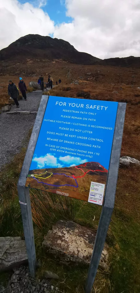
Parking
For this hike, you’ll have to park at the Connemara National Park Visitor Centre. On a busy day, especially in the months of June to September, the main carpark gets very busy, so there is a good chance you’ll have to park along the approach road.
I visited in May, 2025 during some glorious weather and had to park a good 400 metres from the visitor centre, so arrive as early as you can! Parking and entry to the park is free of charge.
The Diamond Hill Trails: A General Overview
There are 2 trails to choose from.
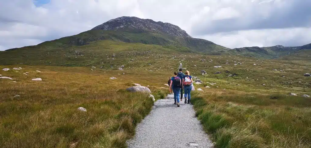
The Lower Diamond Hill Trail is an easy to moderate trail which starts from the Visitor Centre and takes approximately 1.5 hours to complete. This is a looped trail and is ideal for those not wishing to take on hike to the summit.
The Upper Diamond Hill is a moderately strenuous hike. The trail veers off the Lower Trail (but the 2 are connected) and this path leads to the summit of Diamond Hill. It’s important to know that this trail is also a loop and from the summit; the trail continues down the other side of the mountain.
Underfoot/What Shoes to Wear for the Hike
Lower Diamond Hill Trail
For the Lower Diamond Hill Trail, we recommend a sturdy walking shoe with a good grip, preferably waterproof. We do not recommend runners/trainers if the weather is wet, as the boardwalk may be slippery.
Underfoot, the trail is a mix of an excellently maintained path with steps in sections that get a little steeper (although it never gets truly steep) and a beautiful boardwalk elevated above the boggy ground.
Upper Diamond Hill Trail
For this hike, we recommend hiking boots, preferably waterproof and with a good grip. Boots that come above the ankle will prevent any possible injuries.
Underfoot, the first part is gravel and when it get steeper, you’ll find another brilliantly maintained path, with naturally built steps along the way to the top.
The Weather/Best Time to Climb
I have completed this hike in winter, spring and summer.
On each occasion, the weather was glorious and although the summer hike was obviously far warmer, the mountain was very, very busy. Be prepared for that during warmer summer days.
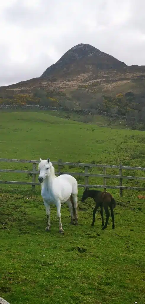
The time I hiked Diamond Hill in April was perfect. The air was mild and there were virtually no crowds. The landscape was beginning to come to life and there were Connemara Ponies with their young in the fields near the visitor centre.
The winter hike was a far more rushed affair as the evenings close in quite quickly this time of the year in Ireland!
Overall we highly recommend a clear/calm day for the hike to make the most of the majestic views, preferably in spring or autumn to avoid the crowds.
What to Wear/Bring for the Hike
This completely depends on the time of year. However, most of the time is is windy at the summit.
A small rucksack
Water
Camera
Thermal layer under pullover if weather is cool and windy (temperature will be approx. 2-3 degrees cooler at top)
Raingear when weather is looking iffy
Suncream for warmer months (yep, you’ll need it!)
Comfortable/waterproof hiking trousers
Thicker socks to prevent blisters
Windproof/waterproof jacket
If cold and dry, a down jacket would be ideal
Change of t-shirt if necessary
Cap that comes over the ears for the wind
Diamond Hill Trails
This section will be divided into the Lower and Upper Trails.
Lower Diamond Hill Trail (Blue Trail)
Trail Type: Looped Walk
Length: 3. 5 km
Starting/Finishing Point: Visitor Centre
Time To Complete: 1-1.5 hours
Difficulty: Easy/Moderate
Elevation Gain: 110 m
Underfoot: Gravel , Mountain Path, Boardwalk
The Lower Diamond Hill is ideal for those who are looking for an easy to moderate hike on a well-maintained, safe path, while still offering beautiful views of the countryside, mountains and coastline.
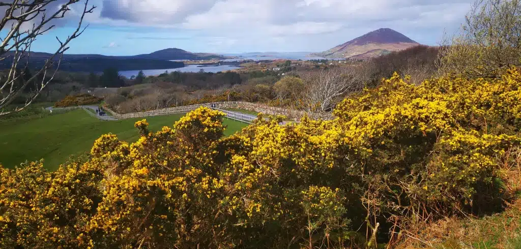
Starting from the playground behind the Visitor Centre, you’ll pass through a gate and to your right you will see a map showing exactly which trail is which.
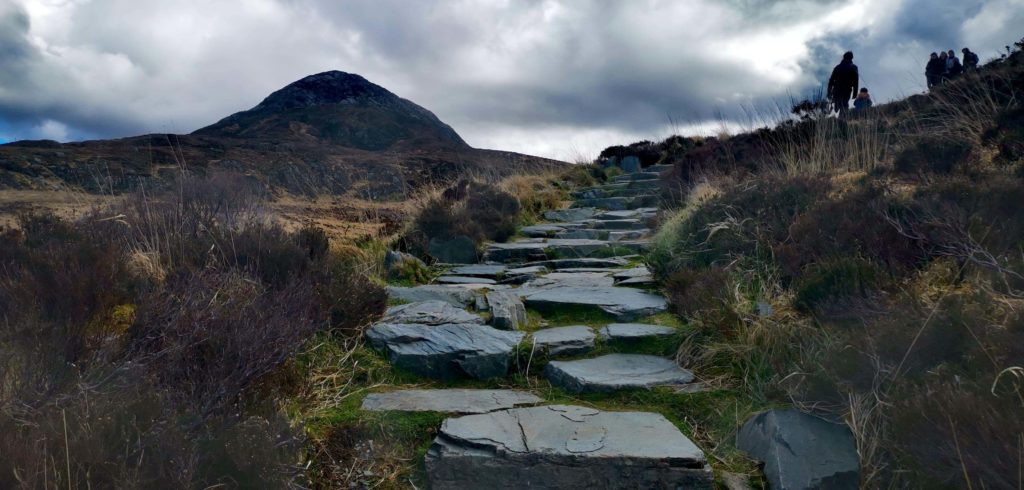
The Lower Trail is marked in blue. The first section is marked by stone walls to your left and sloping fields to your right. After a few hundred metres of a gradual incline, you’ll come to a fork. Go left here (there are blue and red arrows to guide you)

The next section sees the path getting a little steeper, with naturally-built steps helping you on your way. Don’t forget to turn around every so often as the views are starting to open up beautifully.
You’ll soon reach the fantastic boardwalk and this will take you to the highest point of this walk.
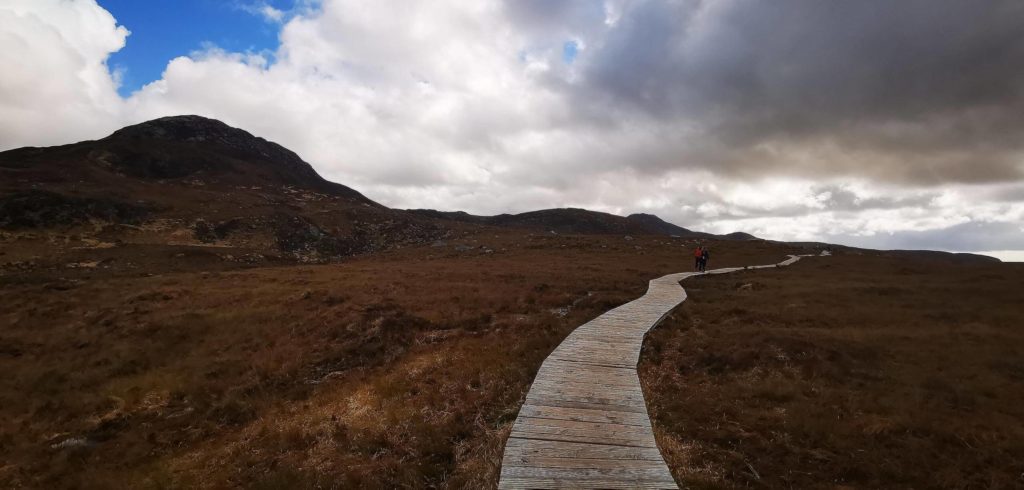
Here, you’ll see an enormous rock with the start of Upper Diamond Hill to your left. To your right, the Lower trail continues downslope and the trail then finishes just behind the Visitor Centre.
Upper Diamond Hill Trail (Red Trail)
Trail Type: Looped Hike
Length: 7.3 km
Starting/Finishing Point: Visitor Centre
Time To Complete: 2 – 3 hours (depending on fitness)
Difficulty: Moderately Strenuous Hike
Elevation Gain: 400 m
Underfoot: Gravel , Boardwalk, Mountain Path, Large Stone Slabs, Steps
So once you have reached the highest point of the Lower Trail, you’ll see a map and this outlines the Upper Trail, marked in red. Walk left and follow the gravel path.
In front of you, Diamond Hill will start to look like a proper mountain now and will appear quite steep! But, don’t worry, the path is a work of art and those who built it should be highly commended!
Take a look to your left and you’ll see beautiful Tully Mountain and the coastline of West Connemara. As you start to gain more elevation, you’ll make out the islands of Inishbofin and Inishturk, along with the southwest coast of Mayo.
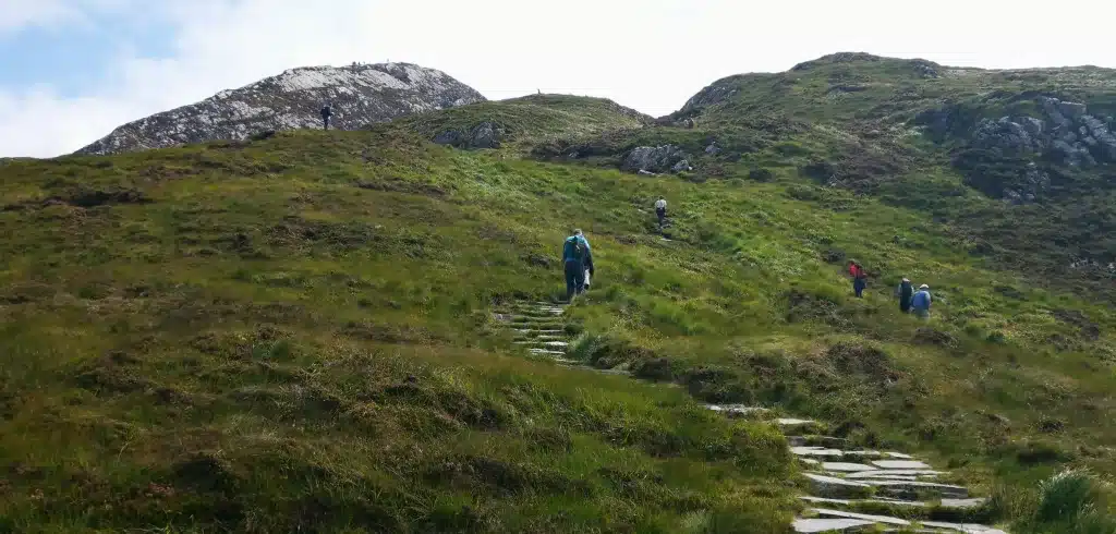
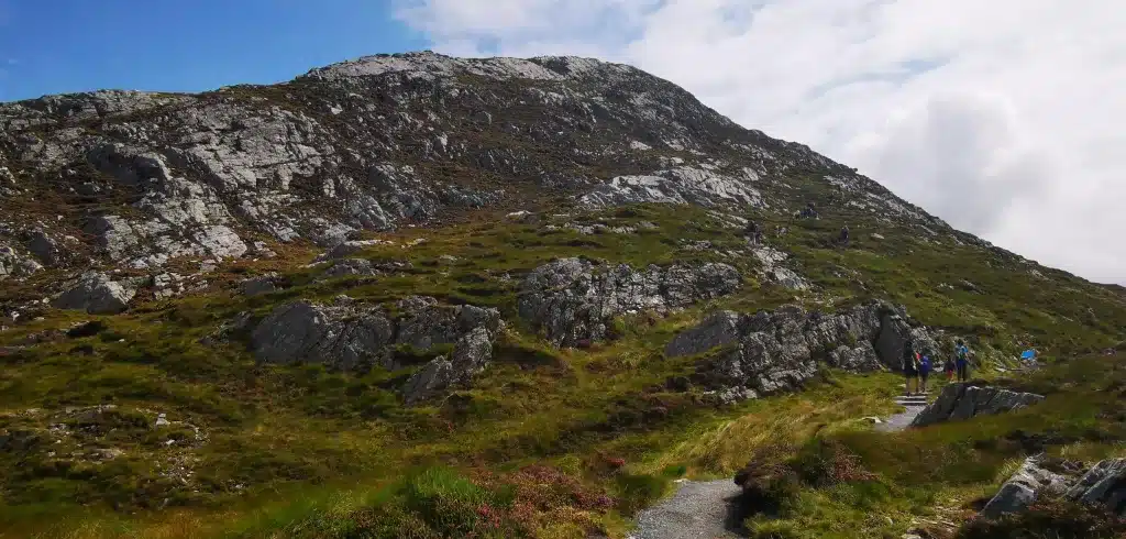
After a while, the gravel path will turn into natural stone steps which zig-zag up the side of the mountain. Eventually these lesser steps turn into larger stone slabs and things get steeper from here on.
There is on particular section where you’ll have to use your hands to pull yourself up some steep rocks, but don’t be alarmed. The section is like going up a small ladder and there is plenty of grip underfoot. That being said, those with mobility issues should not attempt the Upper Diamond Hill Trail.
The heart will get going on this section, so take your time and take a drink if needs be. After 20-30 minutes or so of huffing and puffing, you’ll begin to see the summit.
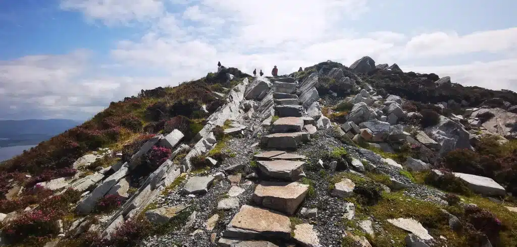
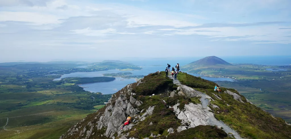
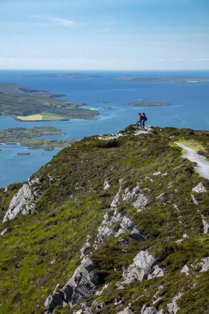
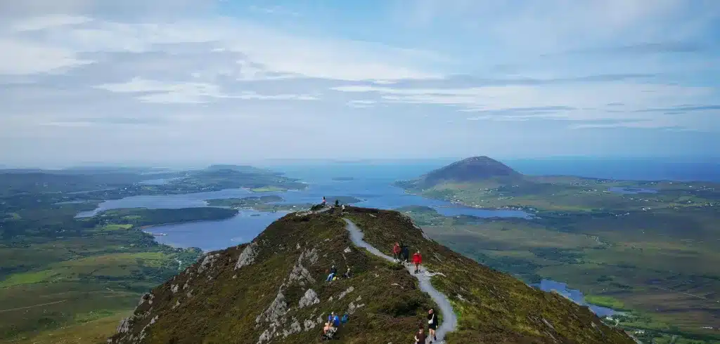
The summit of Diamond Hill is a long plateau and when you reach the first part, you’ll think you’ve made it…But not just yet, there’s still a small way to go. But, the hike is as good as complete now.
The further you walk along the plateau, the more incredible the views start to get. Have a look around and take it all in.

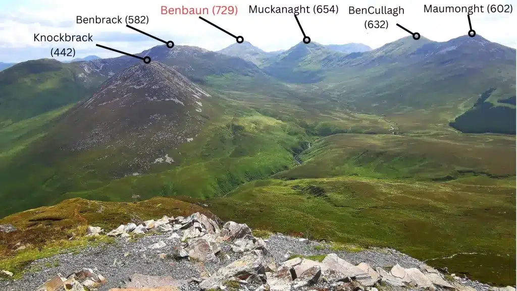
Straight in front of you, you’ll see the beautiful Polladirk Valley, with many of the 12 Bens surrounding it. This image below from my most recent hike shows the view to the valley with the major peaks marked, along with their height in metres.
Notice Galway’s highest mountain, Benbaun, in the background.
Looking west, the view is equally spectacular; the intricate Connemara coastline with its bays and beaches in full view. The islands of Inishbofin and Turk are clear too, and the vast Atlantic stretches as far as the eye can see.
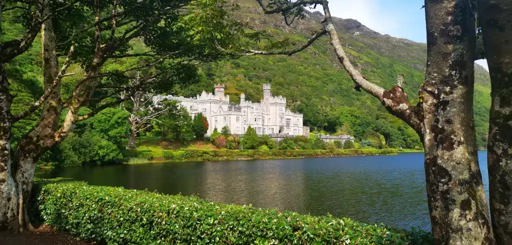
To the northeast, you’ll spot Pollacapall Lough nesteld perfectly in the mountain valley, with the spectacular grounds of Kylemore Abbey along the shoreline.
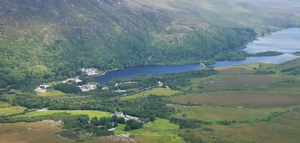
If its a bright day, the walls of the Abbey will glisten beautifully in the sun.
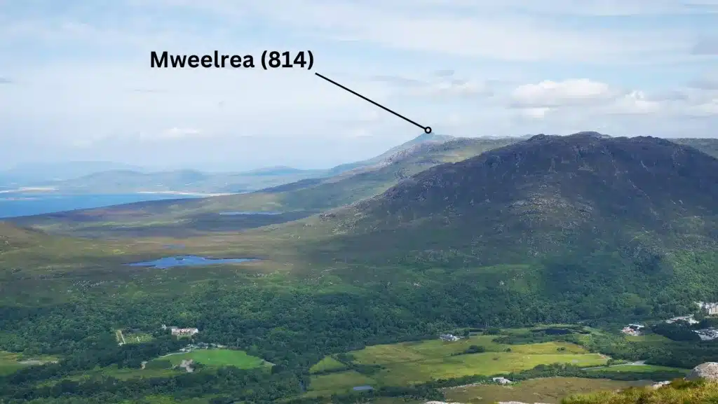
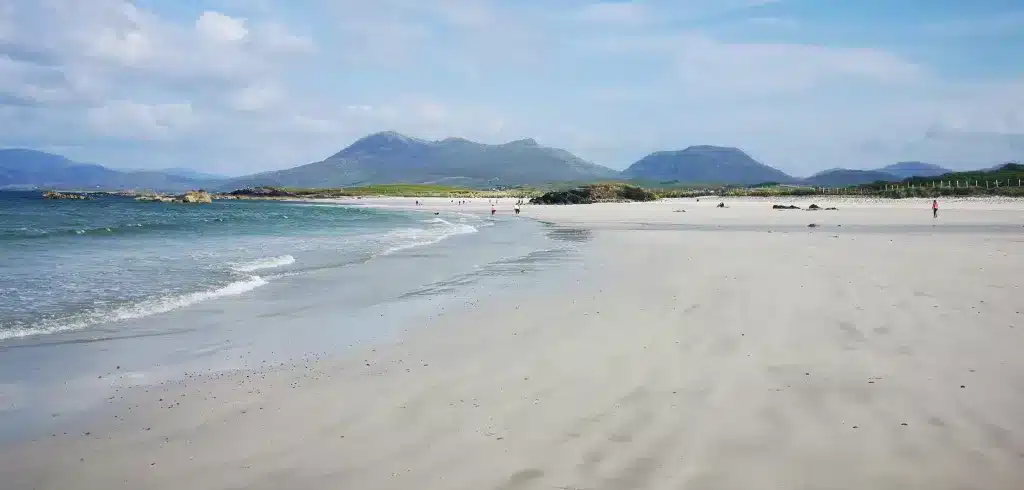
Take a look to the northwest and you’ll spot the long, white, sandy beaches of Glassilaun and Lettergesh and further on, you’ll make out the entrance to Killary Fjord and the distant beaches of Silver Strand and White Strand in Mayo.
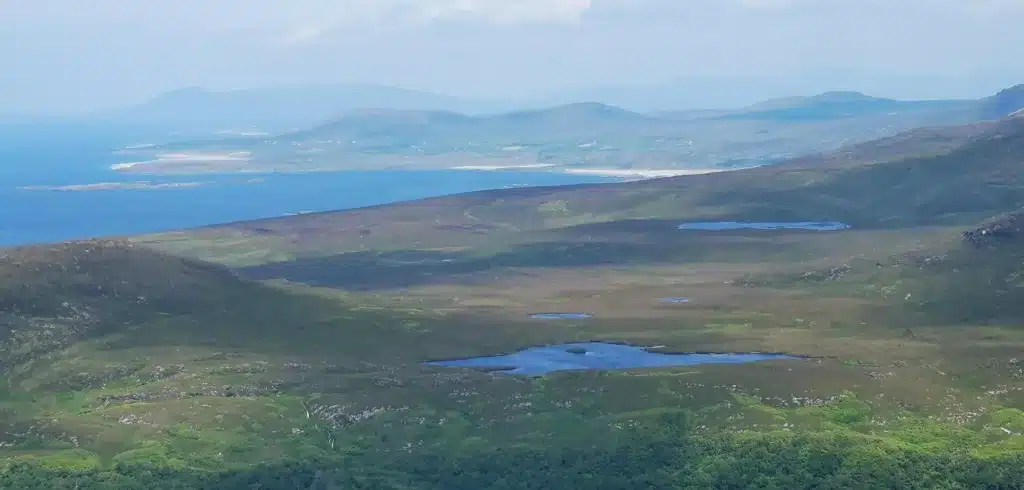
Directly behind Silver Strand, you’ll spot the peak of Mweelrea (814) in County Mayo, twice the height of Diamond Hill and Connaught’s highest mountain.
Take your time up here and sit yourself down. This is the West of Ireland at its very best.
There are few places that offer such scenic variation: mountains, valleys, lakes, rivers, vast bogland, bays, islands and beaches – all to be seen from the summit of Diamond Hill.
When you are ready, make your way over to the other side of the summit and begin your descent back to the Visitor Centre. This path takes you down the far side but eventually you’ll join up to the Lower Trail again.
Other Trails in the Park
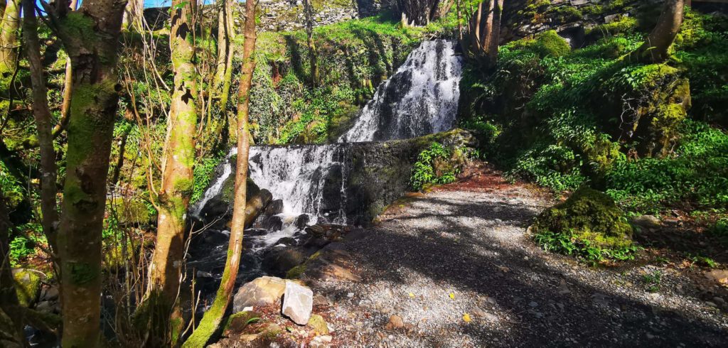
There are 2 other lesser trails in Connemara National Park, the Ellis (marked in green) and Sruffaunboy (marked in yellow.
Ellis is a short 0.5 km trail but involves a lot of steps, so not ideal for young kids/prams. It is a delightful short trail though with a wonderful waterfall. It starts at the visitor centre.
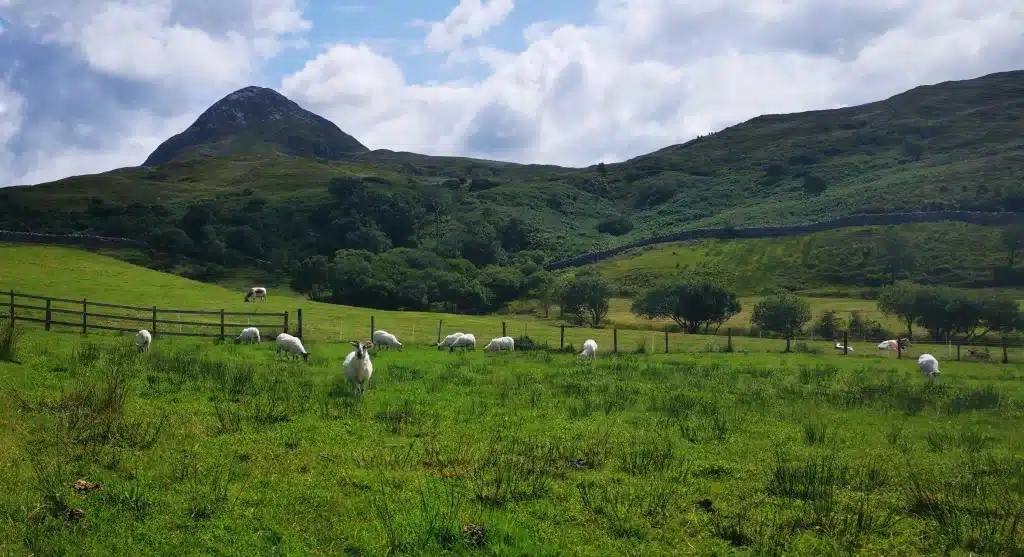
The Sruffaunboy Trail takes in the first part of the Lower Hill Trail and then veers right back down to the park at a total distance of 1.5 km walk. This is a lovely easy walk and if you’ve kids, they’ll more than likely see sheep or Connemara Ponies in the fields. Why not explore the lovely woods along the trail too!
What to do After the Hike/Things to do Nearby
Grab a Bite to Eat at the Hungry Hiker Cafe
The Hungry Hiker cafe in the Visitor Centre is excellent and has a great selection of homemade food available, such as soup, sandwiches, quiche etc. The last time I was there, I had the strawberry and rhubarb crumble. Still taste it…Visitors were highly commending the vegetable soup that day along with the homemade soda bread.
Explore the Visitor Centre
The visitor centre is worth a look as it has some interesting exhibitions, including a a section which talks about the old traditions in the area. Some of these are genuinely hilarious. We have this covered here.
Visit nearby Kylemore Abbey and Grounds
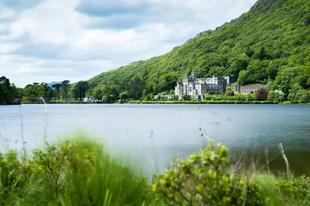
About a 5 to 10 miunte drive away, you’ll find the majestic Kylemore Abbey, which many claim to be Ireland’s most beautiful castle. You can judge that for yourself, but for me it’s a truly special place. The setting alone makes it one of Ireland’s most picturesque places.
A visit to Kylemore Abbey along with the adjoining Kylemore Cafe was exactly what I did on my previous visit. The cafe has a huge selection of food that will satisfy the hungriest of hikers, along with a top-quality gift shop next door.
Entry into the grounds, house and gardens costs 16 Euros. Kylemore Cafe and Gift Shop are located outside of the grounds and you can walk along the lakeside path to take some stunning photos. This is ideal if you are not willing to pay the entry fee into Kylemore Abbey.
Explore some Beautiful Nearby Connemara Scenery by Car
Lough Inagh Valley
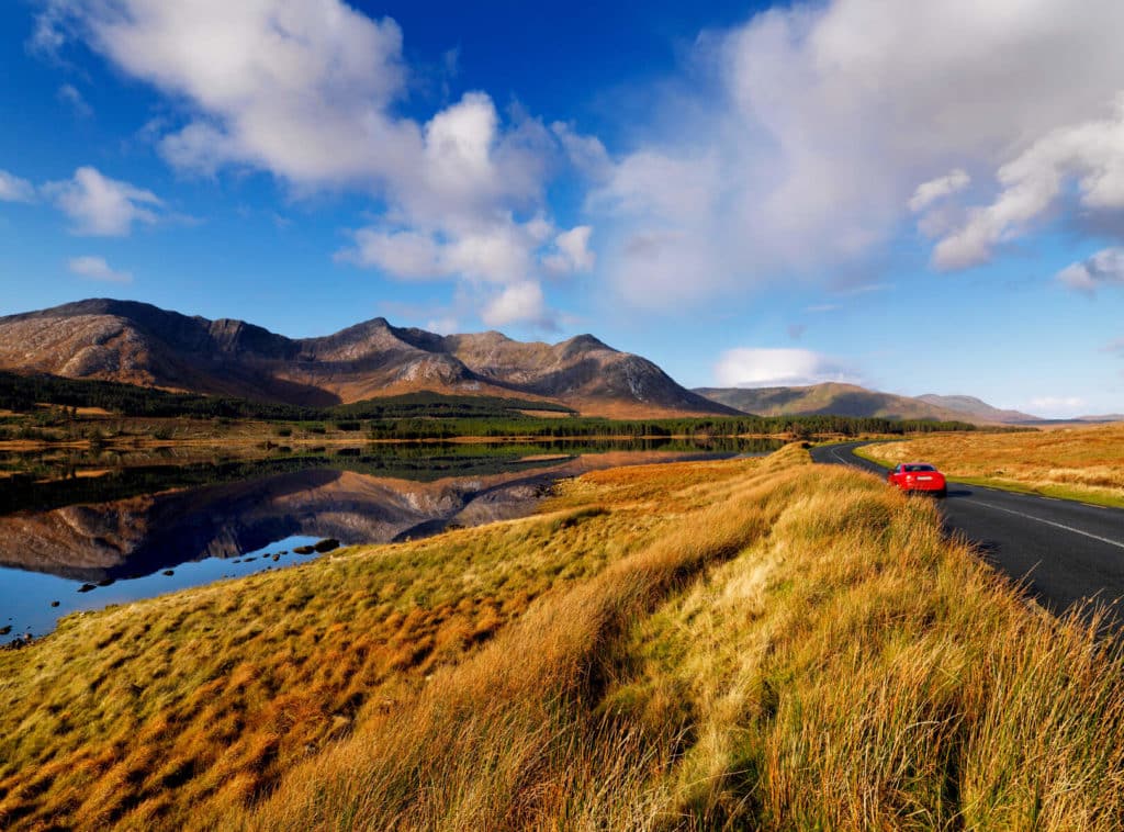
This is one of my personal favourite drives in Ireland and will take you through the vast wildnerss of the Inagh Valley. Make a stop at Lough Inagh, with the majestic 12 Bens forming a dramatic backdrop.
If you came to Connemara National Park from Galway via Clifden earlier in the day, drive back to the city over the Inagh Valley. You won’t regret it!
The Connemara Loop
In summer of 2023 after a tasty dinner at Klylemore, I decided to drive part of the Connemara Loop on the Renvyle Peninsula. I had been to Glassilaun Beach before but never to the beaches of Lettergesh and Renvyle.
The beaches here are absolutely beautiful.
First, make your way to Renvyle Beach and then follow the signs for ‘Connemara Loop’. Drive along the coast past Lettergesh Beach and Glassilaun, stopping in whichever strand takes your fancy. To be honest, they are all incredible white sand beaches, with views to the mountains of Mweelrea and beyond.
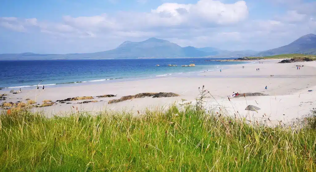
The elevated road offers panoramic views over the whole coastline, with wild plants such as fuchsia and montbretia lining the narrow roads.
Other Hikes in the Region
Croaghaun Cliffs, Achill Island
5 Iconic Mayo Mountains to Climb
Your Questions about Diamond Hill Answered
How long does it take to hike Diamond Hill Connemara?
Depending on level of fitness and stops along the way, it takes an average of 2-3 hours to complete the full Upper Diamond Hill Loop. The Lower Diamond Hill Loop takes 1-1.5 hours to complete.
How hard is it to climb Diamond Hill?
The Upper Loop is a moderately strenuous hike and the last section is the steepest. Because the path is so well built and maintained, this makes it the safest and most accessible hike in Connemara. During wet weather however, care is needed as the granite rocks can get slippery.
How long is the Diamond Hill walk?
The hike to the summit from the visitor centre was measured at an exact distance of 7.28 km. This includes the first section, which takes you along the Lower Trail.
Is Diamond Hill harder than Croagh Patrick?
No. Croagh Patrick is a more challenging hike. The total hiking distance of Croagh Patrick is 11 km and has an elevation gain of over 700 metres, compared to 400 metres for Diamond Hill. The last section of Croagh Patrick is also steeper, but has recently been made safer due to the implementation of natural steps.
Is Diamond Hill suitable for children?
Upper Diamond Hill is not suitable for younger kids. The youngest I saw on the summit was about 10/11. The Lower Trail is more suited for kids from 7, 8 years, but the very first section near the Visitor Centre is a suitable for any age.
Is Diamond Hill steep?
The last section before the summit is the steepest, but there are no loose stones to worry about. The large rocks give a good grip, but make sure you have boots with a good grip if carrying out the hike in wet weather.
Conclusion
If you’d like some more information on Connemara National park, hop over here.
We hope we have helped in giving you a good overview of the Diamond Hill trails. In our view, this is an excellent outdoor activity to do if in the Connemara area. But be warned, on a sunny day in summer this hike gets very busy.
The shoulder seasons of spring and autumn see far less crowds. Whatever time you decide to climb it, you’ll be blown away by the views from the top.